Tree Information
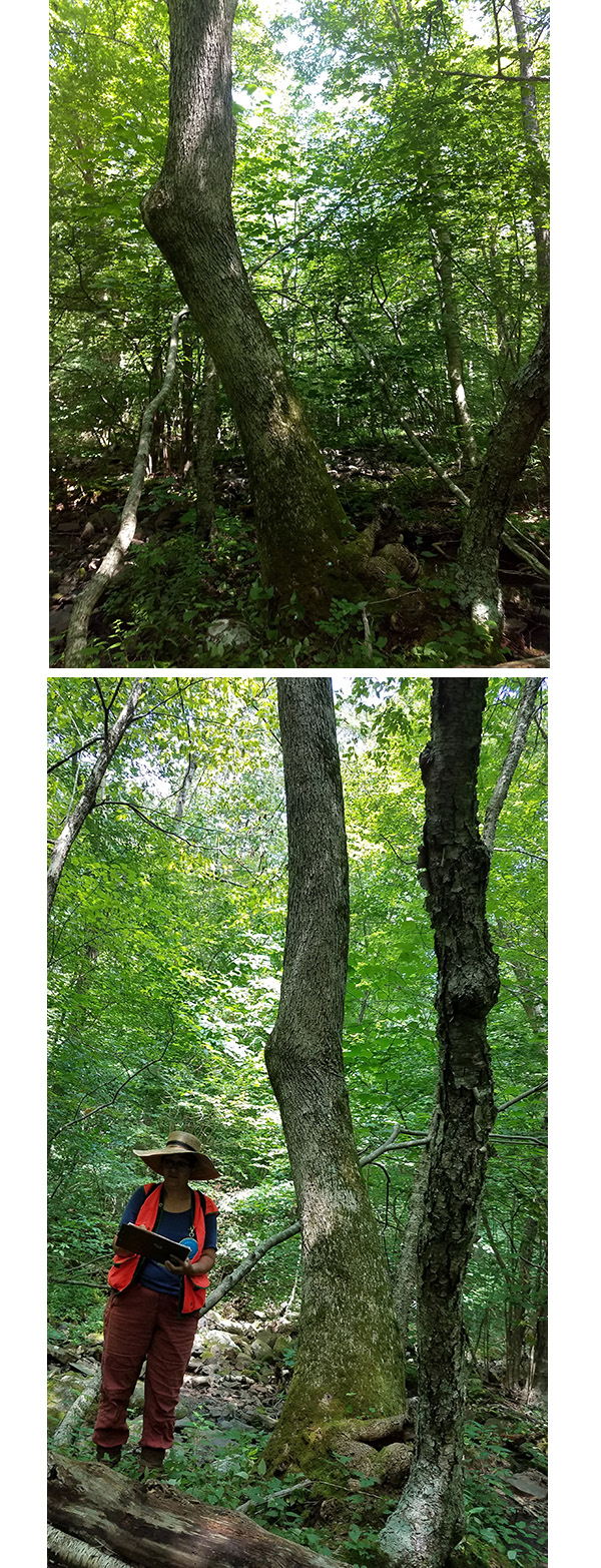
Common Name: black ash
Scientific Name: Fraxinus nigra
Native/Naturalized: Native to Virginia
Database ID: 2685
Status: alive
National Champion: no
Virginia Champion: yes
Trunk Girth: 56 in.
Tree Height: 92 ft.
Crown Spread: 47 ft.
Points: 160
Date Last Measured: 2019
Last Measured by: Meredith Bean, Ed Furlow, Suzanne Ryan, Lara Johnson
Date First Measured: 2019
Comments: Assessed as 40% live crown as of May 2015, treated with emamectin benzoate. Re-treated in July 2019, assessed as 75% live crown. Rare to Virginia, critically endangered due to the emerald ash borer. Most other black ash in the state have succumbed to the pest, hopefully treatment will protect this specimen tree for 3 more years.
Location of Tree
Tree is located in: Madison
Land Owner: National Park Service
GPS Coordinates: 38.40684, -78.47925
Owner Email: dale_meyerhoeffer@nps.gov
Directions: Shenandoah National Park. Skyline Drive MM 59.5, Rapidan, VA 22973. In the Upper Pocosin area of Shenandoah National Park, along the Pocosin Hollow Loop trail. If starting from Lewis Mountain Picnic Area (mile marker 57.5), this group of black ash trees are about 9 miles in, roughly 0.25 mi north of intersection of Pocosin Fire Rd and the Hollow trail. 600 ft west of trail in a small stream. Easiest to approach from Pocosin Fire Rd, 1.5 mile hike in from parking area at milemarker 59.5. Roughly 0.5 mi north of Far Pocosin Mission ruins.
Contact Information
Contact Name: Dale Meyerhoeffer
Contact Email: dale_meyerhoeffer@nps.gov
Contact Phone: 540-999-3500
Contact Info: Dale Meyerhoeffer's phone extension number: x3490. Alternate contact: Rolf Gubler, Rolf_Gubler@nps.gov
Nominators
Original Nominator(s): Meredith Bean, Lara Johnson, Dale Meyerhoeffer, Ed Furlow, Jack Kauffman
Additional Information
Our Partners