Tree Information
Common Name: green ash
Scientific Name: Fraxinus pennsylvanica
Native/Naturalized: Native to Virginia
Database ID: 16
Status: dead
National Champion: no
Virginia Champion: no
Circumference: 252 in.
Height: 73 ft.
Crown: 72 ft.
Points: 343
Date Last Measured: 2018
Last Measured by: Greg Zell
Date First Measured: 1977
Comments:
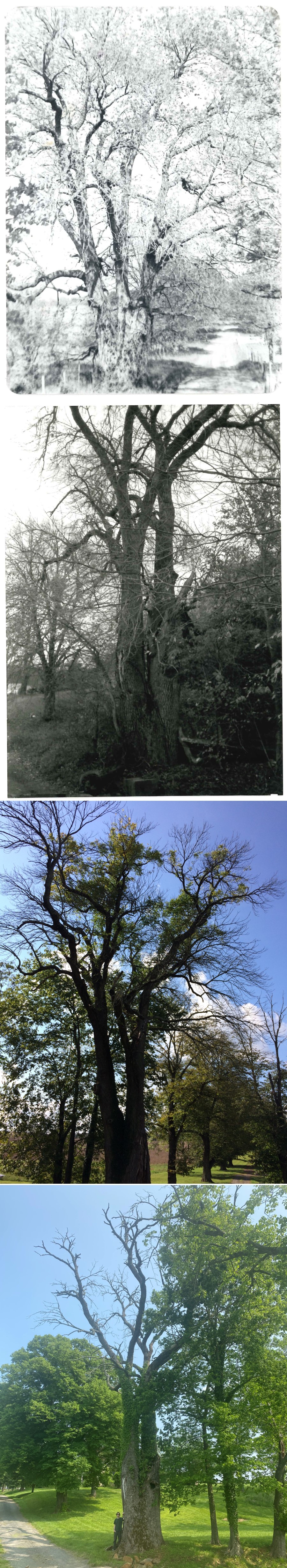
2023 Comments: After suspecting that the tree had likely succumb to emerald ash borer since the last visit in 2018, the tree's death was confirmed in May 2023. The state of deterioration of the crown suggested that the tree had been dead for at least two growing seasons.
2020 Comments: Declared national co-champion in 2020 with other specimens in Ohio and Maryland. Previously measured in 2009 by Byron Carmean, Jeff Kirwan, and Gary Williamson.
2018 Comments: The tree is currently infested with emerald ash borer and has about 40% crown dieback. Tree lost a large codominant leader sometime between May 1977 and December 1993 based on photos, leaving an extensive cavity in the trunk near ground line.
Epitaph: First nominated in 1977 at 323 points. Former owner was M/M Van Roijen. The species identification of this tree flummoxed experts for a long time. It is unclear how or why the original nominator came to the conclusion that it was pumpkin ash (Fraxinus profunda). All modern evidence points to the tree being identified as green ash. Leaf and twig samples were submitted to Virginia Tech dendrology experts and they could not eliminate green ash as the possible identity. Likewise, Tom Wieboldt with the Massey Herbarium said that ruling out green ash would not be possible without samaras. Efforts to track down samaras were unsuccessful. A leaf sample was sent to Mark Strong at the Smithsonian, and he felt confident in declaring it green ash. Thus the identification was changed to green ash in November 2018.
More Photos
Location of Tree
Tree is located in: Fauquier
Land Owner: Davis Camalier, Sr.
GPS Coordinates: 38.70704, -77.82213
Directions: Take lower dirt road to tree. Map and photo on file.
Owner Address: 1629 K St. NW Suite 1200
Washington, DC 20006
Contact Information
Contact Name: Davis Camalier
Contact Email: dcamalier@wrepllc.com
Contact Phone: 202-466-9801
Contact Info: Farm manager is Bill Klooster. Davis Camalier, Jr. was VT forestry student (davis5@vt.edu).
Nominators
Original Nominator(s): Richard Salzer
Additional Information
Our Partners